British Colombia - Chapter 2
- brindlepress
- Oct 31, 2023
- 4 min read
June 1

The highway entering into British Columbia is a straight and long two-lane road. It is not what I would call a highway. It wasn’t paved all the way.

There were few cars and no 18-wheelers. But there were plenty of long 24 or 30-wheelers hauling heavy equipment or bulk material of some kind. The road cuts between patches of forest, opening into pasture and the occasional field of grain. We have brilliant sunshine from a clear sky, unlike the dramatic clouds we enjoyed the previous couple of days. The Canadians seem a little confused between kilometers and miles. There is a sign “Mile105 Road” followed by a mile marker announcing km 216. Of course, the miles are left over from when the U.S. Army Corps of Engineers built the road. Many of the markers don’t have much to do with the distance traveled on this slightly updated version of the thoroughfare. It was constructed in WW11 when the Japanese threatened the U.S. West Coast and Alaska was still a territory. The 1,500-mile-long highway was built in under nine months.

Wherever we went we were never far from the scars of a fire. There are a few stunted wild rose bushes hacked down by repeated verge maintenance. Then there are blankets of golden dandelions reflecting the warmth of the sun. Just before Pink Mountain, where we bought some painfully expensive gas, we came to a ridge and we had an expansive view of Sentinel Peek, our first sight of the Rocky Mountains. The fill of gas cost us $247. 00 Canadian, but that is still a lot.
Then our travels were rewarded with our first bear sighting: A mama black bear with her cub. This was only twenty minutes into our drive.

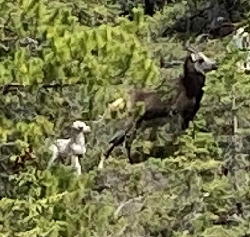
Not a very good picture of these big horn sheep because they were a way off and my phone doesn’t do zoom very well.
June 2
We had a beautifully sunny morning. Lupine lined the side of the road and the pine trees were covered with an abundance of rust-colored pinecones.

We crossed over the brilliant ice-blue Toad River bridge which was a break from the winding narrow road. There were more pastures and horses here. The views were becoming magnificent with lakes and rivers, and snow highlighting the gullies. We needed to gas up, so we pulled over at an establishment we had been aiming at. No gas! “The truck hasn’t arrived,” at our morning stop. The owner persuaded us to get one of his homemade cinnamon buns. It was 11:30 and time for a snack. It was an excellent giant cinnamon roll, quite big enough for the two of us. Fortunately, we were able to refuel a bit further down the road. We always tried to not let the gas go below half full and it paid off. There were a lot of RVs on the road with as many heading south as there were going north. Our goal for the day was Laird Hot Springs, one of the many excellent Provincial Parks in British Colombia. There was a campsite there but we didn’t plan on staying the night. Admission was only $5.00 and we had our own towels and John brought his goggles. It was about a 15-minute walk on a raised boardwalk over marsh and swamp, from the parking area.
The pool was in a very natural area surrounded by trees and plants hanging towards the water. There was a platform and comfortable steps leading into the water and benches you could sit on in the pool. This is where the hot water enters the top pool. It can be as hot as 130º but cooled as it flows downstream.
On the walk back to the motorhome John heard something splashing in the swamp. It was a moose, and then we saw another one on the other side of the boardwalk.
When we got back on the road we came upon a herd of about twenty bison dozing by the road and in the bushes. Then we came across a black bear. Quite a day!
Traveling by RV has its challenges. Although we thought we had everything mechanical checked out, we still had problems. We had camped in the wilderness so were happy that it started for us this morning and we made it as far as Watson Lake. It was Saturday and there were no spare parts there but they could ship a new starter motor and have it by Monday. We were heading that way, (the only way to go from there) so we decided to go to Whitehorse and get it fixed there. Watson Lake was interesting. One of the conscripts who worked on building the Alaska Highway in 1942 was homesick so he added his hometown name to the sign the Army Corps of Engineers erected to indicate the miles to local destinations. The signpost forest has been protected and nurtured by the local citizens, and people from all over the world have added to it. There are now over 6,000 signs.
We made it to Whitehorse, remembering not to turn off each time we stopped, and found a campsite that had a laundry so we spent the day on housekeeping chores.

Our first stop on Monday morning was to purchase a new starter motor which we then delivered to the Chevy dealer. We were there before nine and didn’t leave until after one, but the problem was resolved. On the road again we passed some magnificent vistas of lakes and rivers. Mostly we were driving on a two-lane road with 40ft cleared space on either side. This made for a wide fire break, and it would also be easier to spot animals approaching the road. We didn’t see any animals but there were signs marking significant fires that had previously raged across the land. We could see how the flora had regrown since the 1965 Terry Crossing fire and another later one. Currant fires blazing across Canada were all the TV was talking about for the five hours we were in the Chevy lobby.
Around 5:30 pm we started looking for a place to camp and John located one near Polly Lake. However, a promising dirt trail invited us to the shore of Rock Island Lake. A beautiful spot where Creamer, our dog, could wade in the water. Our only companions were loons and mosquitoes. Thank goodness for deet.


Comments